Southern
Peru &
7 to 19 July 2004
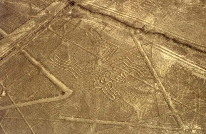
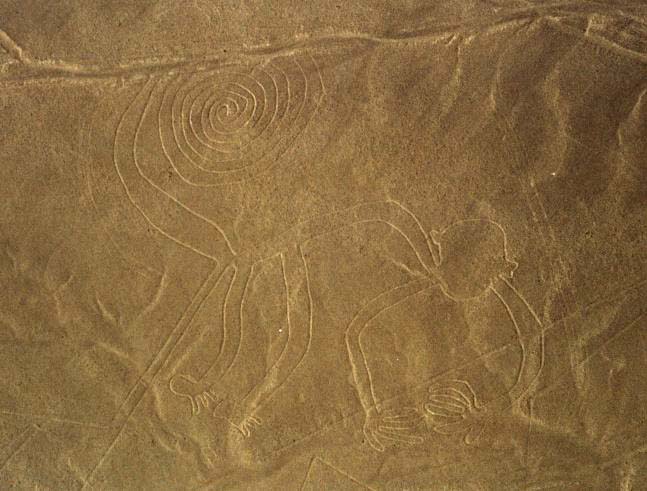
The wonder of the Nazca lines
in
southern Peru is their utter mystery. Forms of animals and trees,
such as the spider and monkey here, are easily discernable on half hour
flights over the barren moonscape, which hasn’t seen a rainstorm in
over a century, but are not visible from ground level. The
dryness explains how the lines have maintained their integrity over the
centuries with no human intervention.
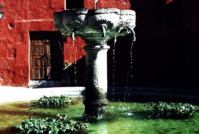
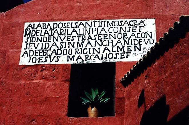
A fountain and sign
typify the style of the enormous Santa Catalina convent in Arequipa,
Peru, which opened to the public in 1970 after four centuries
cloistered in mystery. Non-nuns are still not permitted into the
deepest sanctuary of this remarkable walled complex.
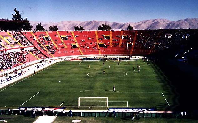
A first round Copa
America soccer match between Brazil (4) and Costa Rica (1) drew scant
interest from local Peruvian fans in Arequipa, who were waiting to root
bitterly against Chile in the following night game versus
Paraguay. Despite the score, Costa Rica had many opportunities to
score on the eventual champions of the tournament.
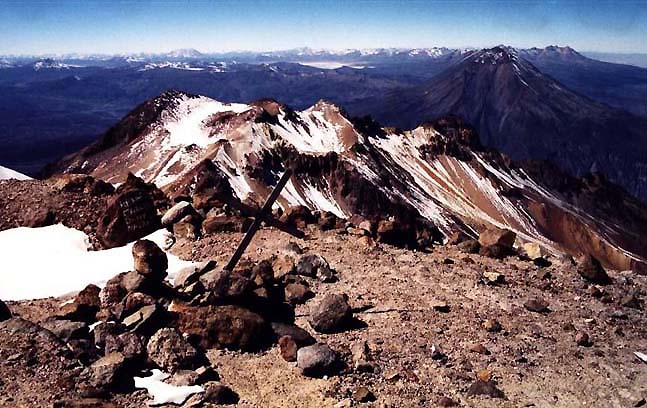
The highest
point I am
likely to reach on this trip was the 6075m summit of Chachani volcano,
near Arequipa, Peru, called by some the easiest 6000m peak in the
world. The night spent at the 5300m camp was chilly but the views
and weather splendid. My first time using crampons and ice-axe
was a blast.
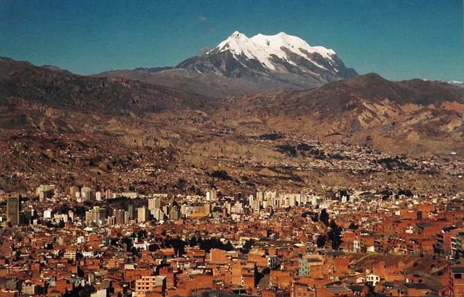
La Paz, the co-capital
of Bolivia, is situated in a 3600m high bowl carved out of the 4000m
altiplano. This breathless view from El Alto illustrates the
city's precarious perch below the snowcapped Illimani peaks.
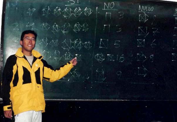
I
participated in the 18 July 2004 referendum in
Bolivia by helping to count votes at the Mesa de Sufragio no. 1612 on
calle Sagarnaga of La Paz. The 'Si' votes represented the people's
will to take a step toward the nationalization of the enormous natural
gas resources in Bolivia.
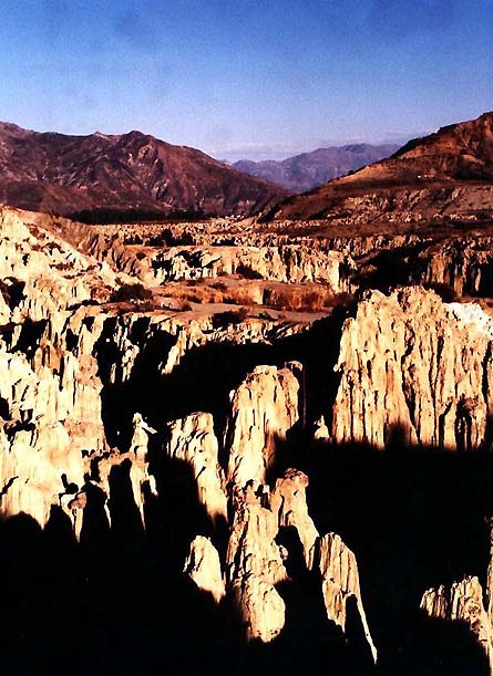
The Valle de la Luna,
just a 20 minute bus ride from noisy, crowded La Paz. The city is
tucked into the bowl just behind
the notch between the two mountains in the background.